A 1980 topographical map of a part of Bosheurne, the origin of the Nijland family. (size 2,5x1km)
By clicking on a farm on the map, you will see a picture of that farm.
The former farm Nijland is in the blue circle
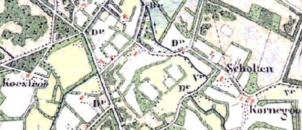
A 1890 topographical map of the Bosheurne. On the left a 1890 map covering the same area as above.
Landoffice map 1832 On the left again a map of a part of Bosheurne, in this case from 1832. The Nijland farm is mentioned.
It is the first map made by the land registry office of that area. The map is turned right compared to the maps above: the north is on the right side. On this map you can see the the old and the new roads. For instance, there is a road along the Nijland farm, which is not there any more on the new maps.